VIKOS GORGE
Hiking Vikos Gorge. A Roadtrip through Epirus
Text: Theofilos Basyiourakis.
Photographs: Anna Kalaitzi.
Trail.Vikaki Gorge to Vikos.
Total length: 19 km.
Hours of hiking without stops: 10 hours.
Difficulty level: 1-3.
In between trails:
a) Monodendri to Vikos;
Total length: 11,490 m.
Hours of hiking: ± 5 hours.
Difficulty level: 1-2.
b) Kokkoros Bridge to Vikos.
Total length: 12,720 m.
Hours of hiking : ± 6 hours.
Difficulty level: 1-2.
The first approaches
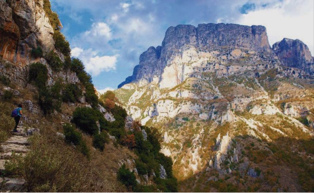
I’m letting time roll backwards and stop around the mid-70s. It was then that for the first time I felt an absolute awe at the sight of the abyssal cliff of Vikos. A cliff that dropped vertically for many hundreds of meters below the balcony of the Agia Paraskevi Monastery, down to the narrow bed of the gorge. Even more frightening was the feeling of emptiness below the unguarded and narrow stone path carved into the vertigo causing vertical slope. After all these years, despite the thousands of images and experiences that I have lived through since then, the memory of those moments still remains alive. In fact, so much so, that every time I mentally transport myself to that steep path, I feel my palms moisten with sweat… I. Lampridis (1) mentions in this regard: “…the mind of someone looking from high up down at this amazing chasm gets dizzy, considering also the possibility of stones rolling and falling down noisily from the heights!”
In the years that followed, I went back to Vikos but without infiltrating “entirely into this horrible and enormous chasm”(2).
However, this distant view, the elusive gaze, barely satisfied our exploratory curiosity about the canyon. It was only a matter of time that Vikos would reveal his hidden secrets to us. So the first “typical” crossing, that is, the one usually chosen by groups and individuals (starting in Monodendri and ending in Vikos), was carried out with a multi-member group of friends in the early 90s. It was a unique experience. The difference, however, in the level of expertise and experience of the hikers, resulted in finishing times between 5 and 7 hours the latter literally with the last light in the depths of the canyon. Worrysome, on the other hand, was the encounter with at least three groups of Albanians, who at that time were using the Vikos crossing as one of their usual routes to Greece.
Since then, our footsteps have led us, several times and at different seasons, to the canyon bed. Sometimes with summer heat and a lot of sweat and sometimes with autumn chill and colorful leaves on the branches. There was no shortage of winter conditions, with a thick layer of ice under the bridges of Kokkoros and Misios.
Crossing Vikos Gorge
The late Costas Lazaridis(3), begins his monograph on Vikos(4), with a phrase from the book by the famous Franco/French-Swiss photographer and mountaineer Frederic Boissonnas(5): “Vikos, the biggest ravine in Zagori. Its steep sides, hundreds of meters high, look as if they were chopped with an ax by some God”. And Lazaridis adds further below: “The ravine of Vikos is a really strange combination of wilderness and natural beauty that cannot be described… while at the same time that the view of the ravine makes the visitor feel something of an awe and horror with the indescribable ferocity before him, he is attracted, charmed, bewitched by some wonderful, rare beauty”.
We begin to cross this magnificent gorge setting off not from the most common starting point, the village of Monodendri, but from the most distant one, the bridge of Kokkoros (6).
The “entrance” of the gorge
Before we start our hike however, we should define its starting and ending points, i.e. where the ravine of Vikos begins and ends. According to Lazaridis “the ravine of Vikos actually begins from the position “Stena”, which is below Tsepelovo and near the Rogovos Monastery” (7). So, if some lovers of long hikes and adventure really want to form a complete view of the geomorphology and the extent of the Vikos gorge, they should start from the “Stena” position, mentioned by Lazaridis or further up, from the stone Hatsios bridge(8).
Here, in fact, is the initial section of the Vikos gorge, known as Pano Vikos or Vikaki, named after the Vikaki river, which is met by the Skamneliotiko stream. According to the most accurate description and data of the outstanding naturalist and mountaineer Antonis Kalogirou(9), this section of Pano Vikos, from the Hatsios Bridge to the Kontodimos Bridge (10) below the Kipi, has a total length of 4,540 meters. It takes 2 hours to cross without stops but requiring swimming of the Vikakis river at some points.
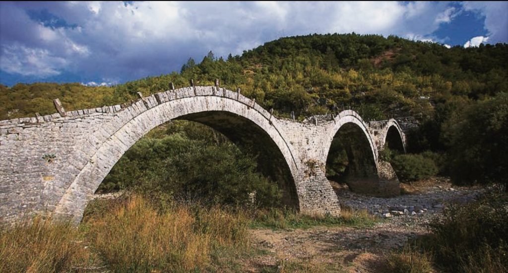
The famous three-arched bridge of Lepida or Kalogeriko bridge, the most photographed bridge of Zagori, with the very apt name “Caterpillar on the move”.
After the Kontodimos Bridge, we follow the wide, flat bed of Vikakis (during the summer) and in 320 m (7′) we reach the meeting point of the Vikakis river with the Kipi stream, which consists of the Lithostroto and Mirisi Streams combined. Continuing along the bed for another 300 m (7′) we come to the front of the three-arch stone famous Plakida or Kalogeriko Bridge (11).
From this point on the river takes the name Bayiotiko stream, from the old name “Baya” of Kipi. Already the route has taken a direction W up to the bridge of Kokkoros. It is a route along the bed of the Bayiot stream, provided, of course, that the bed is dry. Even so, it is a difficult route, on level but rugged terrain, strewn with small and large cobblestones. According to Kalogirou, the route is 1,130 m long taking 25 minutes (12).
Arriving at Kokkoros Bridge we have already completed the first section of the Vikos Gorge, from its actual starting point at the Hatsios Bridge, below Tsepelovo, to our current starting point at the Kokkoros Bridge, below Koukouli. If, according to the description of Kalogiros, we add all the intermediate sections of the route, then the total length reaches 6,290 m., while the time required is 2:45′ hours(13).
In our opinion however, an average hiker having to swim (according to Kalogirou) 7 times in the Vikakis river, will need at least 4 hours.
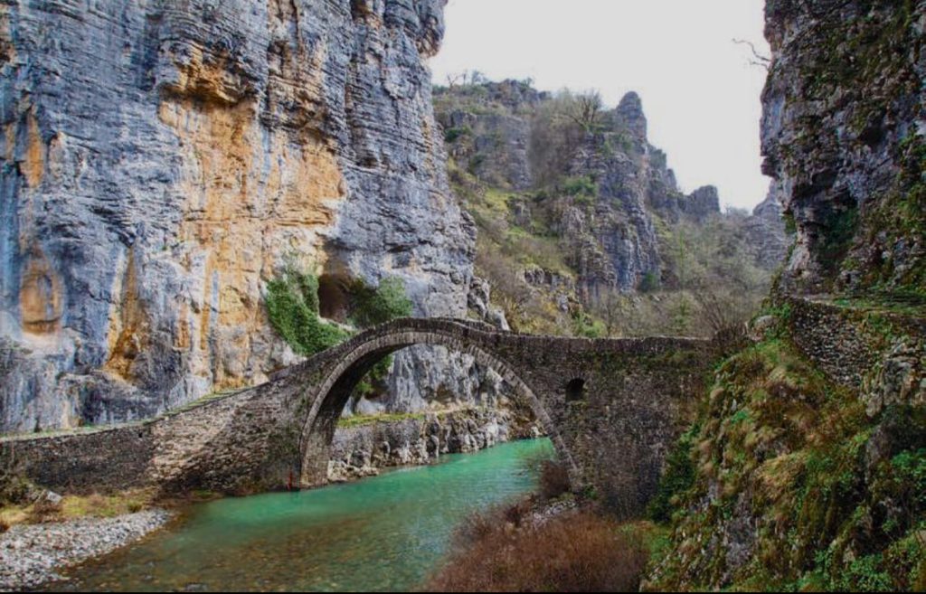
The Kokkoros Bridge, built at one of the most imposing sites of the route. During the winter time “Xeropotamos” has crystal clear water.
Starting from the Kokkoros Bridge
We are already standing under the impressive Kokkoros bridge ready to start our journey to the Vikos ravine. Here the Bayiotiko stream is named Xeropotamos, not an inappropriate name considering that it has water for only a short period of time during the year.
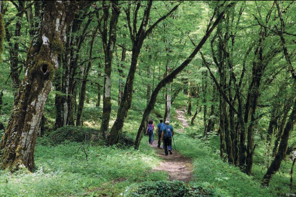
09:30 ́ On the first day of June, we start our hike on the bed of Xiropotamos with our good friends, Nikos and Vasso. Our direction is N and the altitude is 710 m. With red and blue markings on the stones, we quickly leave the bed and enter a nice dirt path, parallel to the river under a generous shade of an exciting variety of trees: hazel trees, oaks and skulls, cedars, maples, gavros and willows and a lonely fir tree. We constantly hear the chirping of many small birds.
09:40′ We briefly cross a beautiful rocky path with a protective wall, right above the bed. Here the protagonists are ferns and a dense forest of gavros, a beautiful and perfectly relaxing route, a true happiness to walk on. After the forest of gavros we get out into the light again while a blooming wild rose tree beckons to us. Impressive oak trees appear into our sight and we get back under the shade.
09:55′ A narrow path branches off to the right and climbs towards Koukouli. A wide cobblestone path starts with dense gavros and hazel trees weaving their branches over it and creating a natural tunnel with absolute shade.
10:00′ In exactly 30′, we reach the strong stone pedestal of the famous double-arched bridge of Misios. On the bridge deck the altitude is 700 meters. We admire the majestic chasm of the gorge, with its towering greyshred limestone rocks, standing vertically above the dry bed of the canyon. A bed that one winter with very low temperatures we were lucky enough to see frozen. We cross the bridge and already on the opposite side, on the left (west), the ascent of the Stairs of Vitsa, the second most famous (after the Stairs of Vradetos), stairs of Zagori (14) begins.
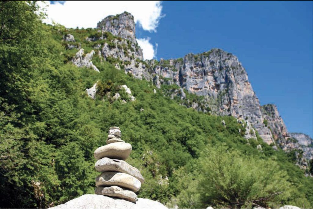
10:05′ With a N orientation we enter the dry bed of Vikos, with a sign to the Monodendri stairs. We initially walk on the left bank, but in two minutes we cross the cobblestone bed and pass to the right, eastern side. Among young firs and gavros trees there is a narrow and beautiful dirt path on which we could walk for hours without stopping. Unfortunately, this bliss is short-lived. In just ten minutes, we are back out on the cobblestone bed. After the sensual contact of our feet with the soft soil, we are again greeted by the cobblestones of the canyon. Blooming acacias are added to the vegetation, red signs and cuckoos (small stone piles) mark our path.
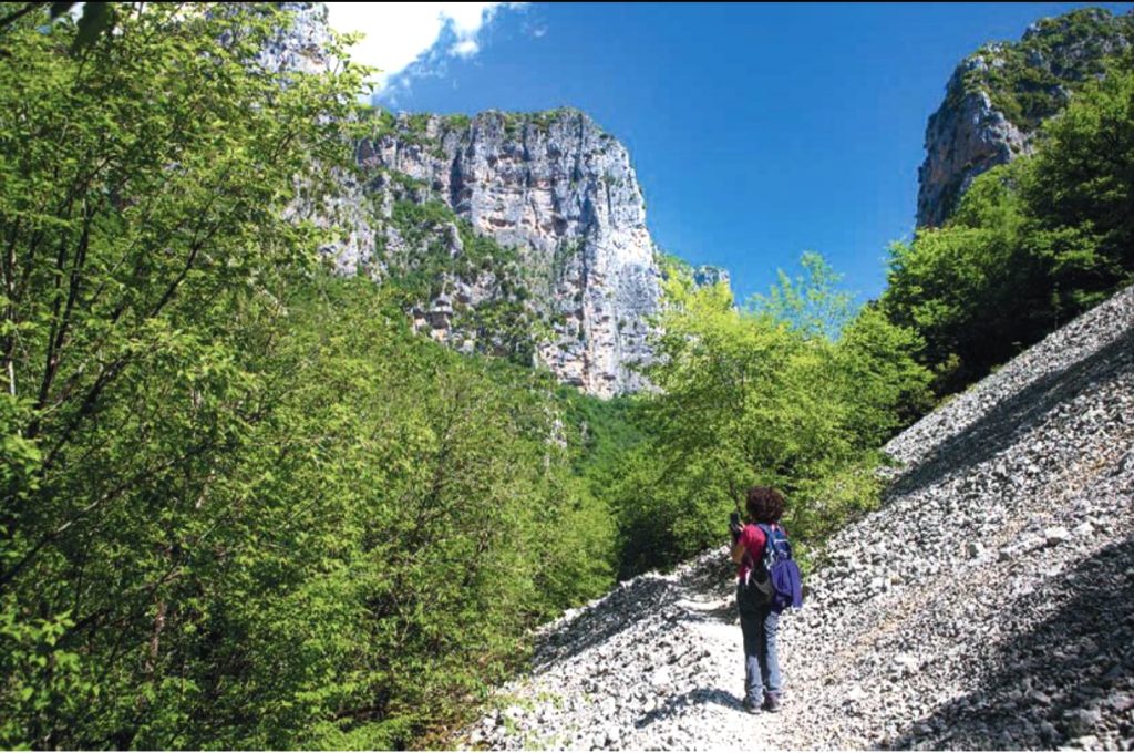
Easily walkable path on the steep slope of the sara across the rocky slopes.
10:20′ With a sign on the left we re-emerge on a pleasant path that lasts 5′. Immediately afterwards we meet “sara” (15) and the path becomes mixed, dirt and stony.
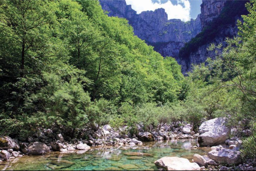
10:30 ́ Just as we begin to adapt to the conditions of the new route, the path leads us again to the bed of the canyon. Here, an unexpected water surface appears. It is a long and narrow “ovira”, that is a water hole with a visible length of at least 80 meters and a maximum width of approximately 20 meters. On the completely still and unwrinkled surface of the water we admire the spectacular reflections of vegetation and rocks. In this peaceful place we stop to rest, waiting in vain for some representative of wild life to appear and quench their thirst in the cool water of the pond.
10:40′ A trace of a red sign and a hint of a path, on the left bank, are enough to make us confident that the continuation of the route is somewhere around there. Very quickly the path moves through to the base of a large Sara, penetrates into thick branches of trees, which we move aside with difficulty and, in general, becomes rough and not clearly marked. It is obvious that at some point we have lost the “mito”, which reliably leads to the crossing of the gorge. After 10 minutes of fruitless efforts, we re-emerge onto the bed, in front of a barrier of huge and difficult to cross rocks, apparently the result of gigantic landslides in an undetermined geological past.
Part of the route, with cuckoo markings, on the dry bed of the canyon.
While we are wondering whether we should return to the water hole to reassess the route or look around for a sign, my gaze suddenly discovers on the right bank a subtle trail that looks like a path. Half a minute later, we are relieved to find that we are on a normal, easily accessible path, with red-white and O3 signs. Walking down the ravine, that is in the opposite direction, a few tens of meters down the road we come to the familiar difficult uphill route, which leads from the bed of the canyon to Kapesovo. In a few minutes we come to the opening of the water hole (ovira) and recognize, going up its coast, the sign which had escaped our attention.
11:10′ We continue our hike with a half an hour delay. We face in awe the hundreds of meters high vertical solid rock slope towering across from us. We follow a smoother, dirt path that looks to our eyes like a national road. In order not to get spoiled though, at some point we go back to the bed and meet the characteristic familiar successive cuckoos.
11:25′ At an altitude of 670 m, we come, on the left, to the fork and the sign to Monodendri. We temporarily leave the bed and take the uphill path to Monodendri. In 5 minutes and at an altitude of 680m we find a new fork, which on the left goes up towards Monodendri, with the “Staircase of Monodendri”, while on the right it continues towards the Vikos settlement, our final destination. Of course we continue to the right.
11:35′ We start on a clear and generally stony path, with successive ups and downs in a continuous and pure gavro forest.
11:45′ We find ourselves at the base of an impressive vertical rock, with a complex root system of ivy, which has been integrated in the rock surface many many years ago.
12:00 Having crossed two smooth saras, we find ahead of us, for several tens of meters, a steep and difficult descent, which takes us to the bed of the canyon. We notice a plaque by E.O.S. Ioannina section, dated 23.9.2012 in memory of Ilias Kazantzis, who lost his life here. We make a short stop in the shade. Besides the hitherto dominant gavros, φραξοι/fronds with their smooth trunks have αλσο appeared. Pleasant visual details, among the rocky bed, are the small coves with crystal clear waters.
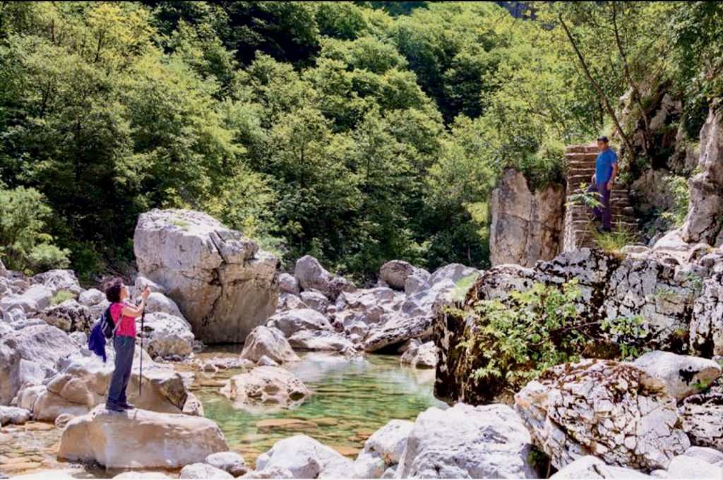
Even in the summer, in some places, water holes with clean water can be seen.
12:20′ Our hiking break ends and a wonderful, hot and humid breeze in the funnel of the canyon cools the midday atmosphere surrounding us. For a few minutes a rough uneven path troubles our steps but next come well-made stone steps and a narrow gorge with carved hollow rocks. The path is still cool and under the shade, enlivened by blackbirds and other small birds.
12:40′ We arrive at a narrow passage, approximately 15 meters long, on the side of a steep slope, an unpleasant site to hikers scared of steep edges. Compared to a previous experience, of course, the situation is now improved (16). A huge and impressively beautiful forest of poplar trees and black gavros, many centuries old, adds diversity and an aesthetic interest to our route. A nature-loving hiker is never bored in Vikos, with different ecosystems and landscapes succeeding one another without interruption.
This ravine, however, which fills us with such strong feelings, has not been mentioned by any ancient authors. I. Lambridis, was also impressed by this inexplicable omission and mentioned it in his “Zagoriaka”in 1870: “It is a matter of wonder how this overwhelming chasm escaped the attention of the ancient historians of Epirus”. Further on, Lampridis mentions “Some Europeans, did write about the famous Vikos, but unfortunately those writings haven’t been found.
We can therefore assume that the first to write about Vikos and Zagori around the middle of the 20th century were G. Hasiotis, I. Lampridis, N. Tsigaras and K. Varzokas, Petros Giannakos in ” Epirotiki Estia” (1954) but also Takis Danos, with his work, “In the Vikos Gorge Charadra”. There is a passage in this text sayning: “It is really worth the effort to cross this ravine, a unique phenomenon in all of Europe according to the experts. Once there you will find yourself in another world, the world of peace and silence. You will find yourself in the Kingdom of eagles and wild animals”…”. We continue on a very downhill and slippery path, covered with garbilli. A rocky ascent follows, assisted by a rope.
13:30 With the expectation of Voidomatis we leave Klima and start on one of the most beautiful parts of the route, on a nice path shaded by towering white and black gavros, some of which exceed 25 meters in height. Lower down, in the bed of the gorge, we hear the murmur of the Vikos river flowing between the stones with transparent water. We are all grateful for the great privilege, to be able to hike in the Vikos ravine, in such a special landscape. But how did the name “Vikos” come about and what does it mean? According to the prevailing opinion, supported by Lampridis in his “Zagoriaka” in 1870, “…. to us the word is, like of most of the places in Zagori, Slavic, meaning an echoing place”. And indeed, the reverberation of a voice or even the click of a rifle in the canyons of this ravine creates a very interesting phenomenon. K. Thesprotos and A. Psalidas (18) report very characteristically: “… in this great chasm, as you empty your rifle, you hear the same sound repeated 10 and 12 times successively, reflected in the rocky caves until it eclipses”.
A vivid description is given by Nestoras Georgitsis, in the “Ipirotiko imerologio Calendar(?), 1914″: “Shortly after this, the sound of shots and deafening shouts of people created an indescribable commotion and disturbed the peace of eagles and vultures which came out of their nests flying majestically”.“
Every now and then we also raise a voice the reverberation being returned to us but not multiplied. Perhaps the volume of our voice is to blame, but most probably the choice of the point we’re standing, which does not favor the creation of multiple resonances.
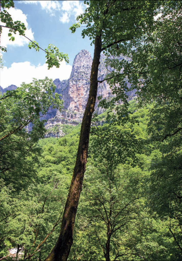
An unusual image attracts our attention. It is a wild or horse chestnut tree, growing not on the ground but inside a rock. The trail is still very enjoyable. However, for some time now, we don’t hear the murmur of the water which has disappeared into the bowels of the canyon bed. At some point the NW horizon opens up and the giant solid rock wall of Guvostitsa, in the SW foothills of Astraka, is revealed in the background. With a peak altitude of 1,900 meters Guvostitsa creates the most abyssal chasm of Vikos, with an altitude difference to the bed that exceeds 1,300 meters (19)!
14:30′ We arrive at an old iconostasis, built with a combination of stone and cement. Here there is a giant sloping rock creating a unique natural canopy, an absolute protection in hostile weather.
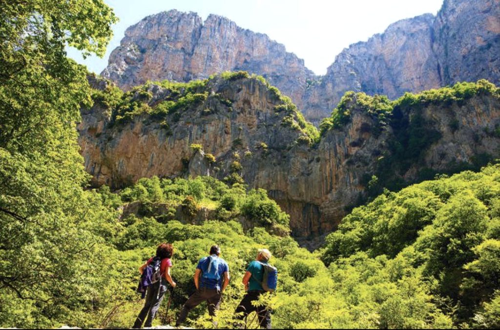
Magnificent forests and very steep slopes alternate continuously throughout the route.
13:10′ The huge chasm of Megalakkos(17) looms across from us, starting as a shallow stonewalled stream from the southern foothills of Tymfi, developing into a magnificent and inaccessible canyon that ends in Vikos.
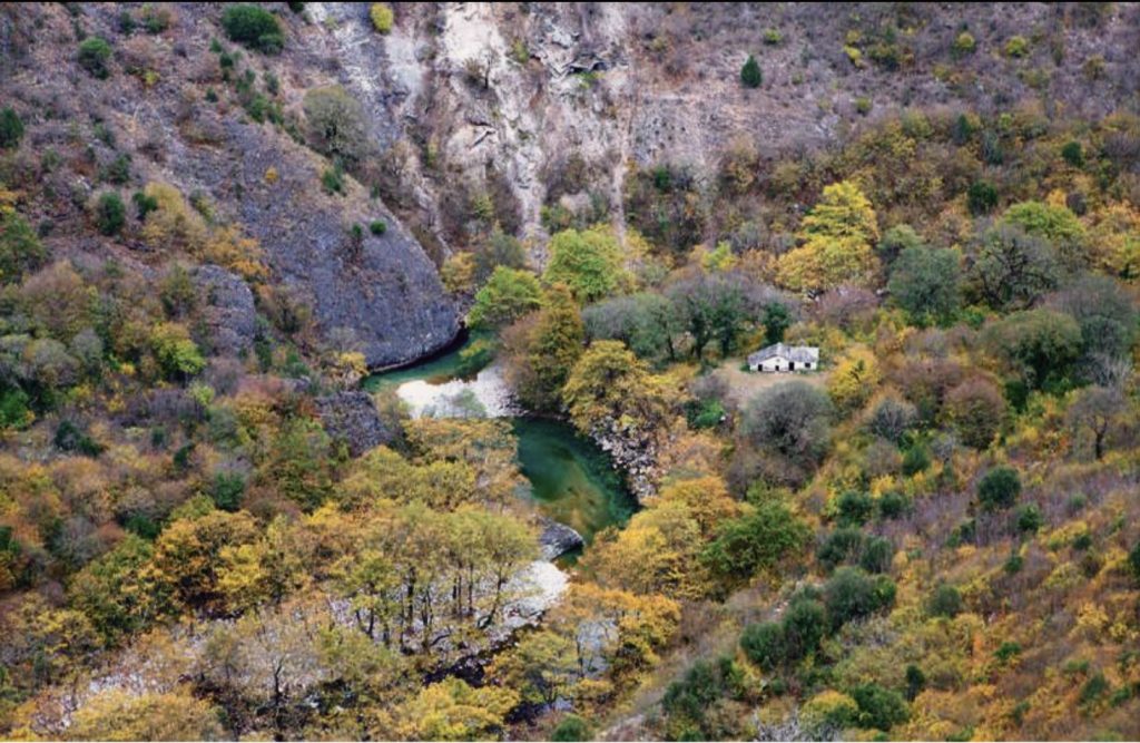
Already in 10 minutes we reach the “Klima” water source, at an altitude of 630 m. A little further down we come to the confluence of the Klima stream, which flows through Megalakko, and Vikos with its crystal clear water. Unfortunately, to our great disappointment, the Klima spring, with a tap built in 2008, is dry. It is the first time in our many visits that we are deprived of its cool water.
I tell my friends to be patient. In about two hours we will quench our thirst with the icy, divine water of the Voidomatis river.
The uphill stone-paved “Vikos Skala” and the sensational steep slopes of Guvostitsa mark the end of the long journey on the bed of the Gorge.
15:20′ For the first time we see, through the foliage of the trees, the familiar wooden kioski, our desired destination at the “Rachi” location of the village of Vikos, one of the top observation points of the ravine. Already, a few minutes ago, the first plane trees and pieces of old cobblestone have appeared.
15:35′ A sign at an altitude of 505 meters shows us a not particularly distinct path to Papigo and the Voidomati springs. The roar of the river can already be heard from lower down. For a few minutes we ascend a narrow, coarsely made cobblestone path enjoying the scents of blooming faskomilo trees. The ascent becomes difficult with added steps and gravel. The sun, which had been hidden until now shines, particularly hot, through lead coloured clouds.
15:50 At the end of the ascent, a fork descends to the right towards the one-room small church of Panagia of Charadra, a real jewel with a pitched roof covered with shale stones. Straight ahead the fork leads to a difficult uphill path to Vikos, smooth at the start but then becoming a coarse cobblestone one. In about 7 minutes we reach a beautiful forest clearing above the Voidomatis stream.
The very picturesque little church was once the main Church of the Monastery of Panagia, built in 1738. The painting of the interior of the church is due to the painter priest Soudeniotis Ioannis and his sons, in 1773. The style of the church’s iconography follows the popular trends of painting that were in use in Epirus during the 18th century. The wooden carved iconostasis was made in 1761. It is worth mentioning that portable icons from the 18th century and also one of Christ the Almighty from 1694 were found inside the church. However, in its current state, the church needs some maintenance, care and overall upgrading, in order to withstand the inevitable wear and tear of time.
Our admiration of the religious monument is followed in a minute by our admiration of the first stages of the genesis of the Voidomatis river, a gigantic natural pool of incredible beauty, with the most transparent, turquoise and crystalline waters of any other Greek river. All around, a large and lively group of boys and girls enjoy the privileges of their age and carelessness, while the most daring ones test their endurance in the icy water of the river. We kneel on the ground, literally and figuratively, dip our faces in the stream, quench our thirst with the divine water, which springs up through the stones, a few meters above the riverbed.
Surrounded by autumn colours, the small church of Panagia looms low, next to the initial sections of the Voidomatis river.
16:20′ As we begin to ascend from the river bank, first a flash of light and immediately afterwards a muffled sound of thunder warn us of the impending development of the weather. We quicken our pace but at the entrance to the church the rain catches with us, a violent, authentic summer rain. We find temporary shelter inside the church. In ten minutes we attempt a heroic exit, the rain has somewhat eased.
16:45′ We start the ascent under continuous rain which, since we are soaked already, ceases to concern us. As we gain altitude and head out into the open, the wind picks up, the rain feels like frozen needles on our faces. What is most annoying and unpleasant, however, are the wet, slippery stones of the cobblestone trail which ends in the village. This is the famous winding “Staircase of Vikos” which, of course, is a small – or even big – test, after so many hours of hiking. Small stops for recovering our breath, a stone iconostasis in a nice view position, a few turns and at 17:30, 45′ after having left the church of Panagia, we reach the asphalt at the entrance of the village.
We have completed, since 09:30 in the morning till 17:30 in the afternoon, 8 hours of total stay and hiking in the Vikos gorge. We consult our notes and conclude that the time of clear hiking is exactly 6:15′ hours.
Our dear teacher Kostas Ioannidis welcomes us with a tsipouraki on the edge of the cliff. Right across, Guvostitsa has again been shrouded by fog.
Epilogue
As a reward to the rain-soaked and sweating uphill hikers the nature of Zagori, summoning its generosity, orders the rain to stop. Huge black clouds, chased by the winds, constantly change their volume and position in the sky, moving away from above us and converging on the highlands of Astraka. At the same time, a brilliant afternoon sun escapes through the clouds and sends fiery beams of light to the rocks of Guvostitsa. We also come out of our sheds and climb a few meters to the “Rachi” of Vikos, next to the kiosk. We greet our good friend, the teacher Costas Ioannidis, in his own “Rachi”, his beautiful little shop with the variety of herbs and traditional products of Zagori. Our friend hears that we have just crossed Vikos and offers us a tsipouraki. Not at a typical table with chairs but on handmade stools in his little garden. His little garden, next to the kiosk and on the edge of the cliff, is the top balcony of Vikos. From here we let our gaze and thoughts wander into the immense funnel of the ravine which, a few hours before, revealed to us some of its wonderful secrets. The “Teacher” combines the tsipouraki with fragrant vegetable pies which his wife Dora had baked a little while ago. This exquisite tsipouraki and these cheese and herb pies are difficult to forget. To say I’m not tired would be a lie. It is though a sweet tiredness and I congratulate myself for having felt it with my friends in a place like this.
(1) Ioannis Lampridis “Epirotic agathoergimata, Zagoria” Athens 1870 (Reprint Society of Epirotic Studies, Ioannina 1971).
(2) Lampridis, op.
(3) Kostas Lazaridis from Koukouli (1904-1989), was a teacher, writer, historian, naturalist and folklorist. During his lifetime he collected and classified (noting also their Latin names) more than 1,250 different species of plants from the Vikos gorge and the wider Zagori area. Included among them are the medicinal herbs used by the famous “Vikogiatroi”/“Vikos doctors”.
(4) K. Lazaridis, “Come to Zagori to admire the Vikos Gorge”, Ioannina 1970.
(5) “L’ Epire berceau des Grecs”, Geneva 1914. Boissonnas together with his traveling companion Daniel Baud Bovy and the hunter Christos Kakkalos from Litochoro were the first persons to conquer, the Mytikas peak of Olympus in August 1913.
(6) The imposing Kokkoros or Noutsos bridge, is one of the most photographed in Zagori. It was first built in 1750, paid for by Noutsos Kontodimos from Vratetos. In 1910, its maintenance was financed by Grigoris Kokkoros from Koukouli leading to its current name which has prevailed ever since.
(7) Hellenic Panorama, issue 84, Nov – Dec 2011.
(8) According to Lampridis, the bridge was built in 1804 by Lambros Hatsios from Tsepelovo. It is a large single-arch bridge, with an arch span of 17.50 meters, an arch height of 9.90 meters, a deck length of 43.20 meters and a width of 4.90 meters. It bridges the Skamneliotiko Rema, as the Paliogephyro bridge also does a few hundred meters further down. This bridge (the Paliogephyro) is considered one of the oldest single arche bridges of Zagori. It was built around 1700 under the sponsorship of Georgios Partalis from Skamneli. It has an arch span of 9.50 m, a height of 10 and a width of 2.80 m.
(9) A.Kalogirou, “The Zagori paths”, books A+B Kritiki editions 2005.
(10) The Kontodimos bridge is located at the exit of the ravine of Vikakis, at an altitude of 745 meters. It was built in 1753 under the sponsorship of Takis Kontodimos from Vradeto. The span of the arch is 15 m, the height 7.80 m, the length of the deck 20 m and the width 2.90 m.
(11) The most impressive and most photographed bridge of Zagori was built in 1814 under the sponsorship of the igoumenos of the Prophet Elias Monastery in Vitsa, Seraphim. It was then maintained by the Plakida families, the Koukouli community and the Archaeological Service. The spans of the arches are 15, 13.5 and 11.20 meters. The respective heights 6, 7.60 and 4.80 meters. the total length of the deck is 56 meters and the width is 3.15 meters.
(12) At midday, on the summer day when we made the crossing, it took us 35′.
(13) According to Kalogirou, the distance of 1,000m. between the Kokkoro and Misios bridges is normally covered in 20′, without taking into account our own stops for photos and notes.
(14) An exciting and completely original article about the most important “Stairs/Skales” of Zagori (Vradetou, Vitsa, Kipon, Koukouliou, Monodendriou, Vikou, Kakia Skala) has been published in Helliniko Panorama, issue 84, Nov-Dec. 2011.
(15) “Sara” on an outdoor route we call a steep slope, covered with small and large stones, which make it slippery and, depending on the slope, dangerous.
(16) There was a not-so-pleasant incident with a lady in our group at the first crossing of Vikos years ago, fortunately without unpleasant consequences.
(17) There is an exciting description of Megalakkos and Kakia Skala in the Greek Panorama issue 84, Nov-Dec. 2011.
(18) “Geography of Albania and Epirus”, 1964.
(19) According to the “Guinness” book, the Vikos gorge is the deepest in the world in proportion to its width, since at some point the depth is 900 and the width is 1,100 meters, i.e. the depth is 81% of the width.